East Tyrol
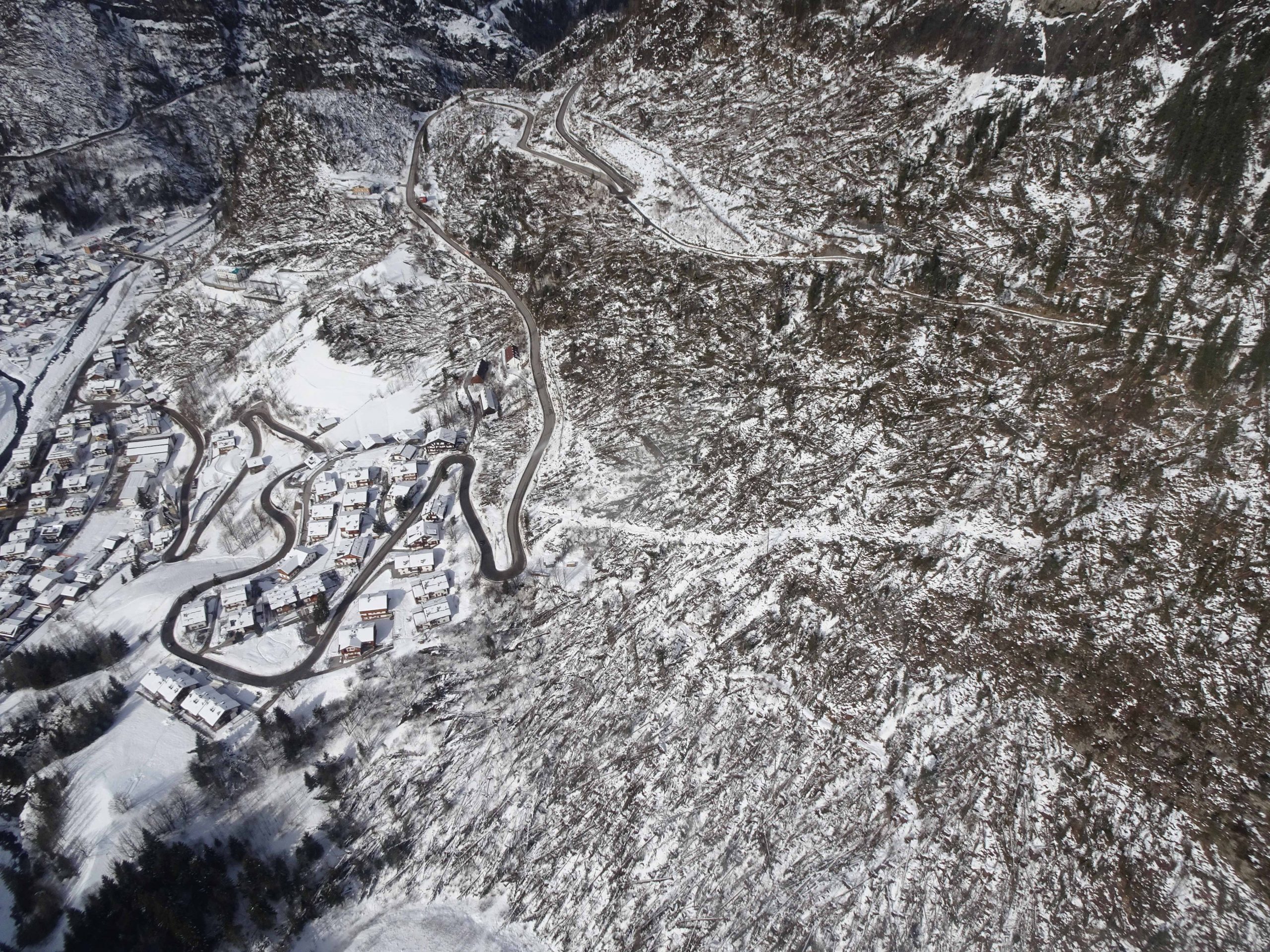
The region of East Tyrol is particularly suitable as a study area for various reasons. This mountainous region borders directly on the Italian national border and therefore already meets the project requirements for geographical reasons. Alpine natural hazard processes occur in East Tyrol in all their forms and are often associated with previous storm events as cascade or multi-hazard effects. In addition, Osttirol is located in the central Alps, where the effects of climate change will probably be felt more strongly. Osttirol was severely affected by the storm “Vaia” at the end of October 2018. The effects of storms and storm damage are therefore still very topical in this region!
-
-
- STATE: Austria
- REGION: Austrian State of Tyrol
- PROVINCE: Lienz
- MUNICIPALITIES: 33
- PEOPLE: 50.000
- AREA: 2.020 Km2
- POPULATION DENSITY: 24.5 ab./Km2
- ALTITUDE RANGE: - m.s.l.m
-
Osttirol is the south-east part of the federal state of Tyrol and also known as the Tyrolean district Lienz. This region covers an area of 2,020 km², whereby the share of settlement area is only 8.7 % (175 km²). The population is around 48,700 as of 2019 [1]. About 16.300 buildings exist in Osttirol and the transport routes all over the region include 4.200 km of roads (as of 2015) and 50 km of railways (as of 2009). Tourism in Osttirol is not particularly strong compared to other touristic regions in the rest of Tyrol. However, the region has recorded over 2,000,000 overnight stays per year in recent years. Currently (2020) 55 cable car installations in East Tyrol exist, with a decreasing trend since 2010 [1].
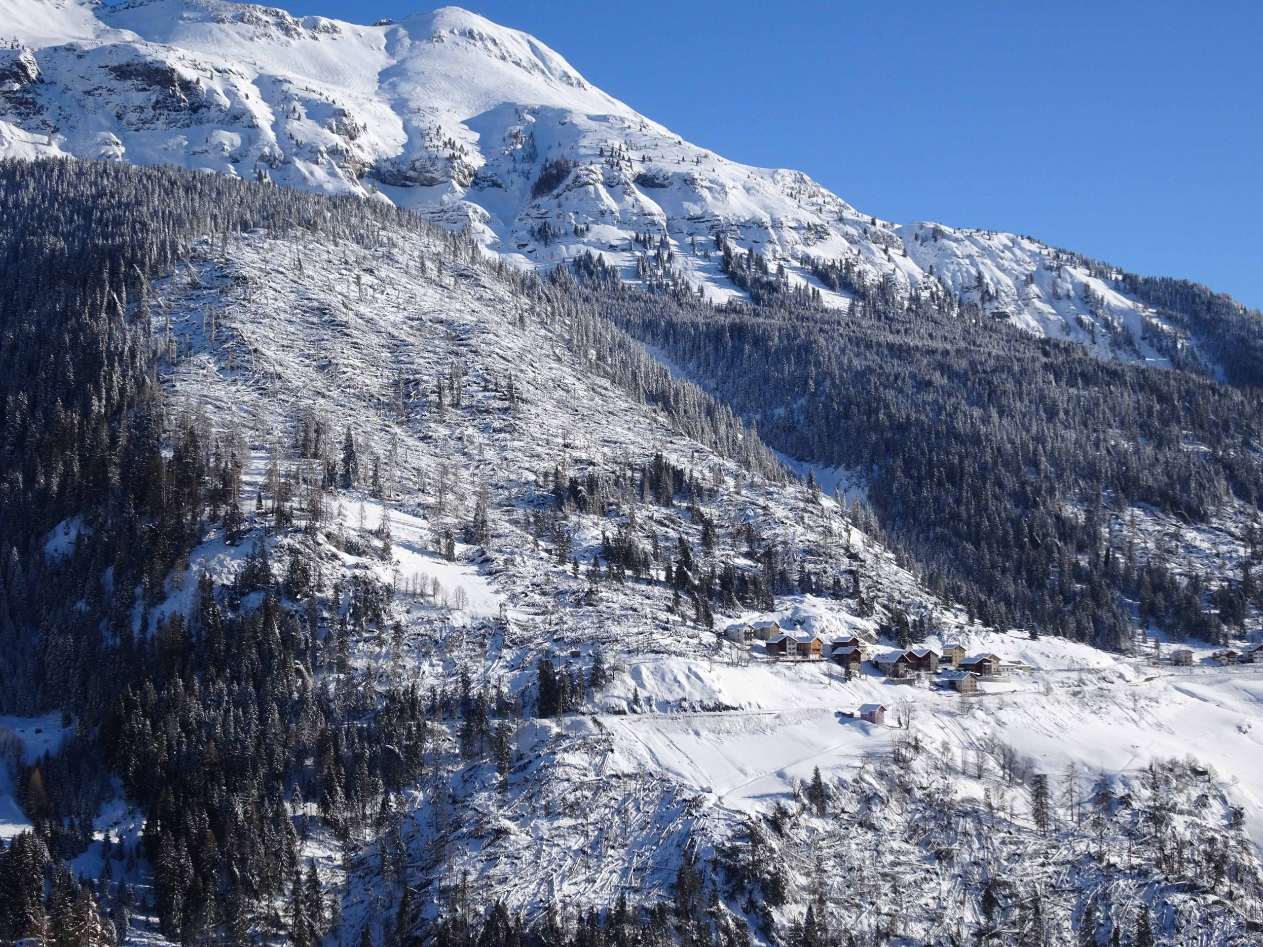
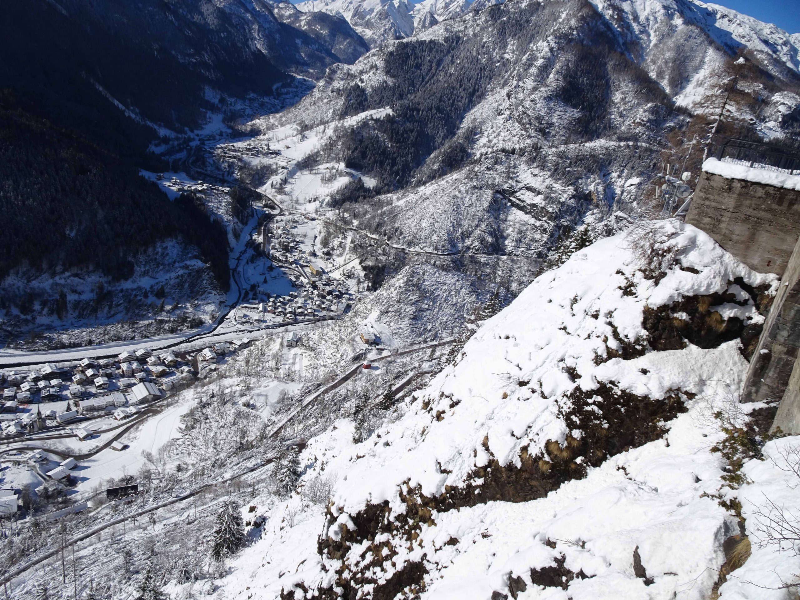
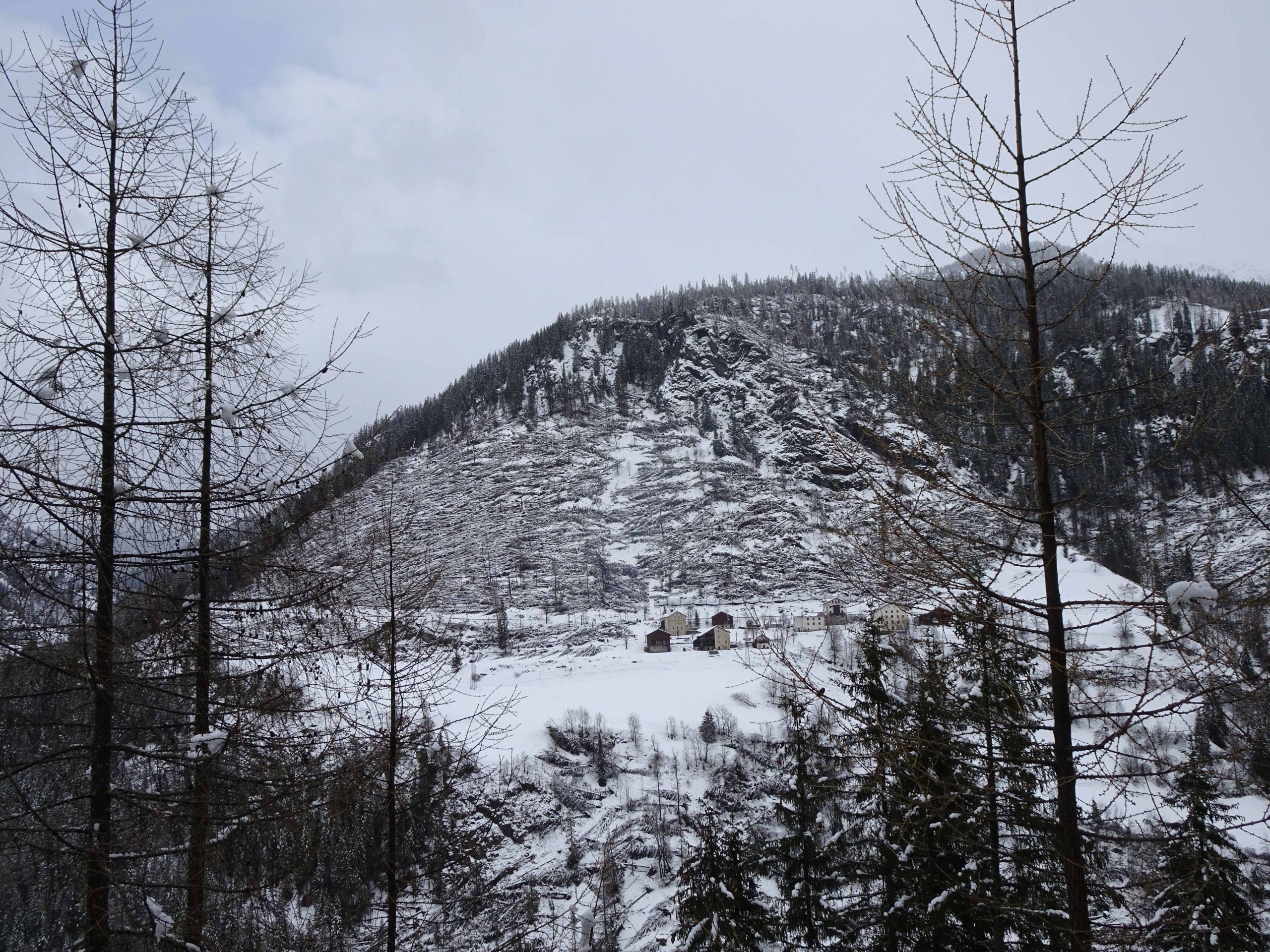
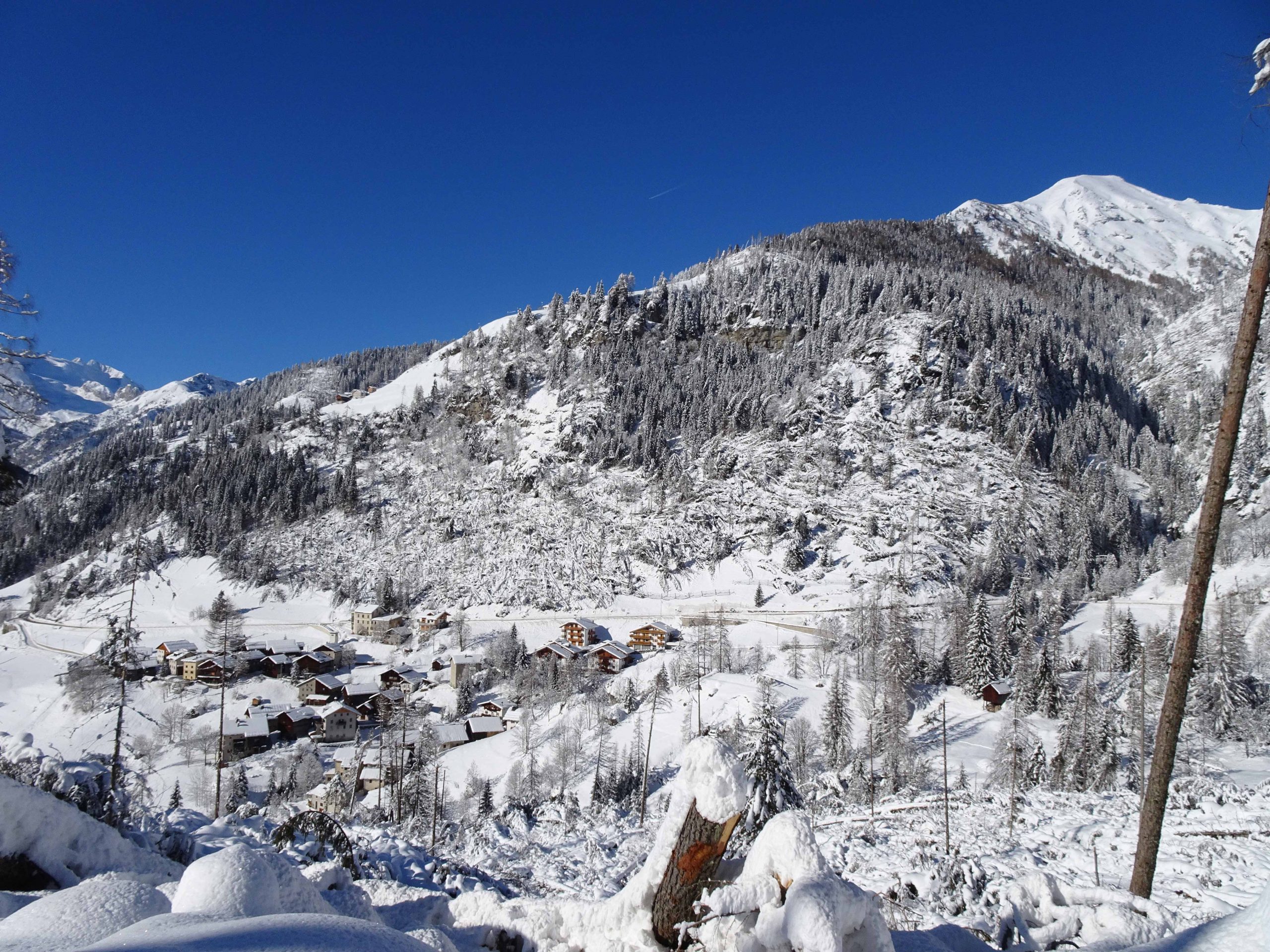
The storm “Vaia” swept across Osttirol (and Carinthia) in 2018 with estimated wind peaks of 180 – 220 km/h [4], leaving large areas of bare forests as well as considerable damage to infrastructure [2, 3]. The accompanying record-breaking rainfall also led to numerous floods [4] & mudslides [3]. All East Tyrolean municipalities were affected by this event. In the forest, more than 500,000 cubic metres of damaged timber have been harvested on a total damaged area of 2,100 hectares. More than 60 % of the affected area can be assigned to the category of object protection forest [3,4]. The loss of the protective function of forests on this scale is unprecedented in Austria [3]. Thanks to the good forecast of the extreme event by the weather models (ZAMG Carinthia) and the early warning, personal injuries could be prevented [4].
The damage left behind by the storm is not only a (financial) disaster for the individual forest farmers [2]. The far greater threat to the general public is posed by the large-scale loss of forest and the resulting massively increased risk potential of avalanches, landslides and rockfalls. Almost seventy percent of the East Tyrolean forest is needed as object protection forest due to its location and therefore directly protects the settlements of East Tyroleans. Due to the storm “Vaia” and the loss of the protective forest, important transport routes and entire settlements were threatened by an intensified hazard risk scenario from one day to the next [2, 4]. According to the BMLRT (Federal Ministry of Agriculture, Regions and Tourism), the technical and biological measures (rockfall nets, avalanche dams, reforestation, etc.) necessary immediately after the windthrow event will cost around 65 million euros (for East Tyrol & Carinthia) [3].
In addition, high secondary damage to the protection forests is to be expected due to bark beetle calamities [4] and a decline in timber prices [2]. Due to the bark beetle calamities, it is to be expected that within 5 years the same amount of damaged wood will be added to the amount of wood thrown down by the storm [4].
The storm damage and fatal consequences in the example of “Vaia” in East Tyrol are obvious and will continue to have an effect for decades after this event, which lasted only a few hours to days. Especially with regard to future events of a similar magnitude, East Tyrol is particularly interesting for an in-depth elaboration in the Trans Alp project.
SOURCES:[1] Amt der Tiroler Landesregierung (2021): Landesstatistik, https://www.tirol.gv.at/filead- min/themen/statistik-budget/statistik/downloads/Regionsprofile/Stat_profile/bezirke/Li- enz.pdf; accessed: 2021-04-28
[2] Sandbichler, R., Huber, A.M. (2021): Schützt der Wald uns noch? Berg & Tal, 12 Februar 2021; https://www.dolomitenstadt.at/story/schuetzt-der-wald-uns-noch/
[3] Bundesministerium für Nachhaltigkeit und Tourismus (2019): Sturmtief „Vaia“ 2018 Kärnten und Osttirol. Ein Jahr danach – Schäden und Maßnahmen.
[4] Verein der Diplomingenieure der Wildbach- und Lawinenverbauung Österreichs (2020): Ostti- rol und Kärnten – Studienreise 2019 des Vereins der Diplomingenieure der Wildbach- und La- winenverbauung Österreichs; Journal for Torrent, Avalanche, Landslide and Rock Fall

Agordino - Cordevole Valley
Agordino - Cordevole Valley

Agordino - Cordevole Valley
Agordino - Cordevole Valley
Agordino - Cordevole Valley
Agordino - Cordevole Valley