Agordino - Cordevole Valley
The Agordino area is considered ideal as a case study: it has the traits of a typical Dolomiti valley and it has been severely affected by intense weather events in recent years. Agordino is in the province of Belluno, approximately located in the high and medium water basin of the Cordevole stream, right tributary of Piave river.
-
-
- STATE: Italy
- REGION: Veneto
- PROVINCE: Belluno
- MUNICIPALITIES: 16
- PEOPLE: 18.593 (al 31.12.2020)
- AREA: 538,47 Km2
- POPULATION DENSITY: 34.5 ab./Km2
- ALTITUDE RANGE: 450 - 3.000 m a.m.s.l.
-
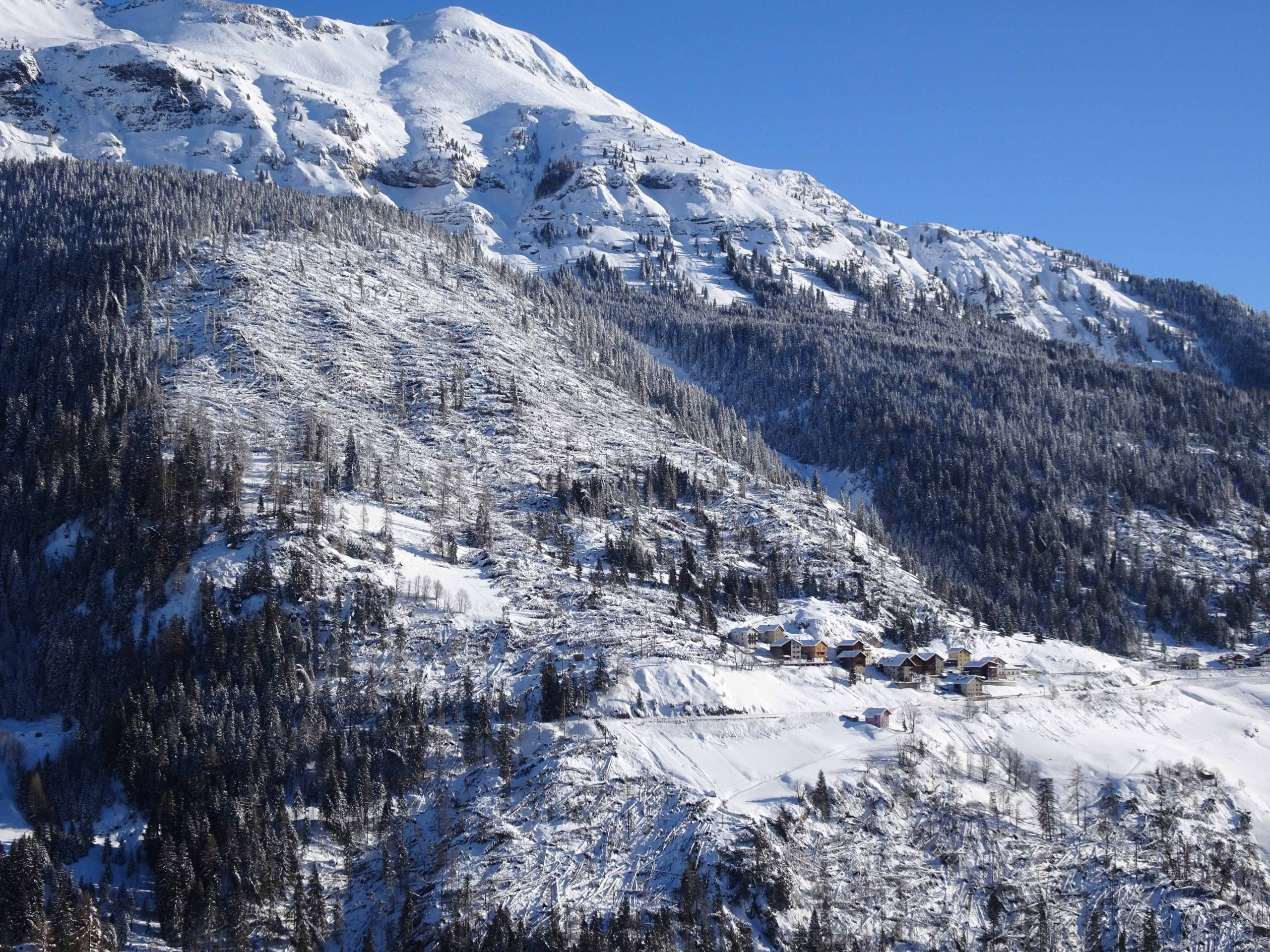
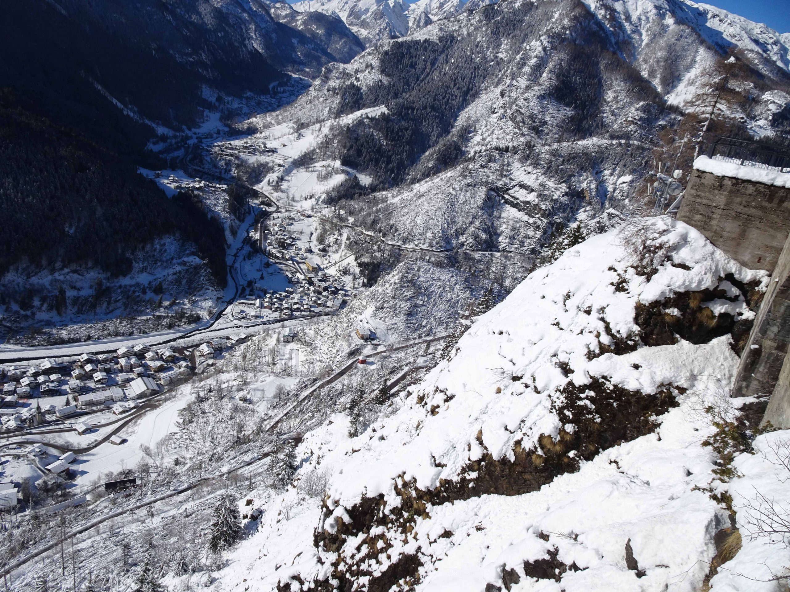
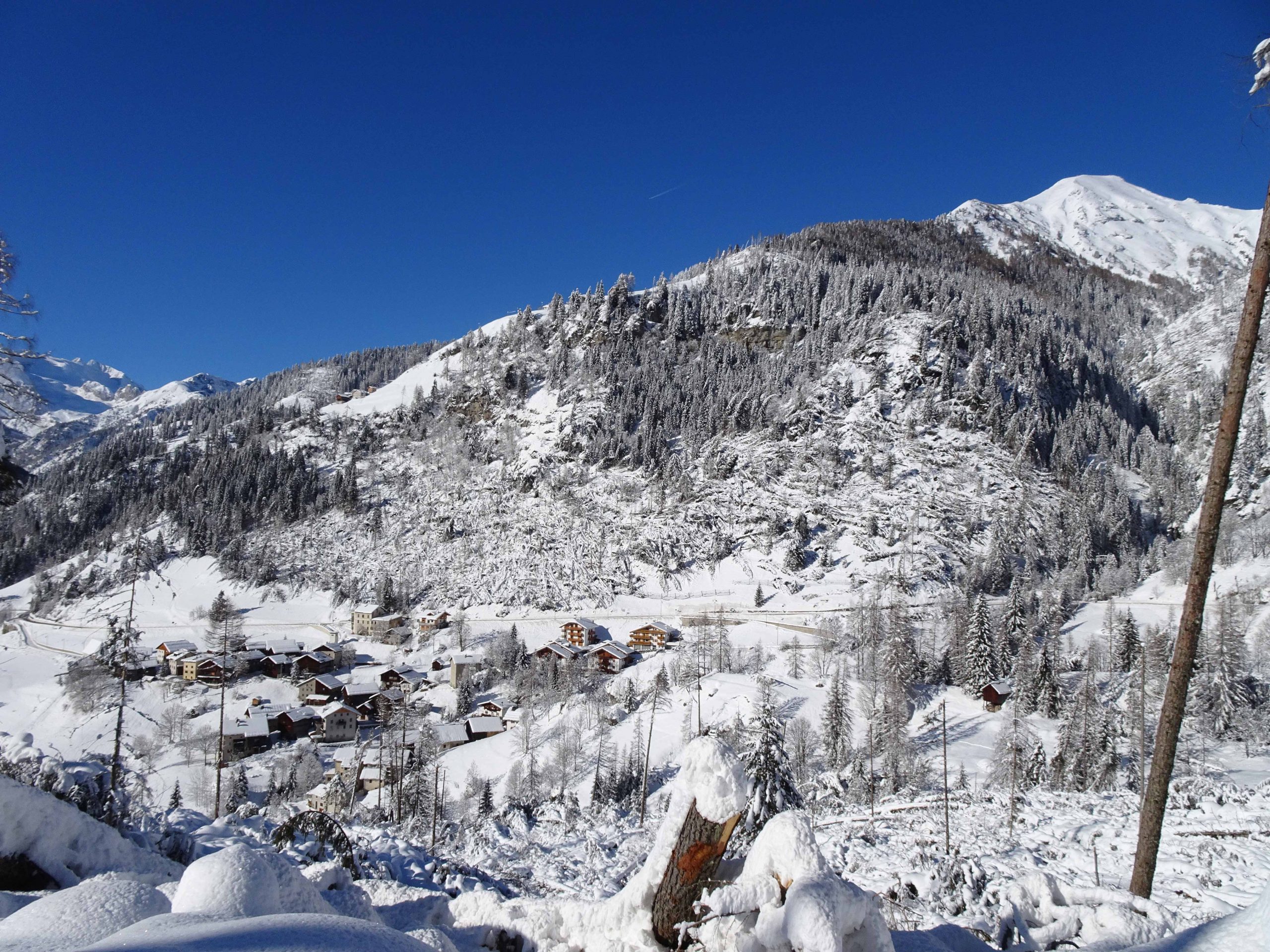
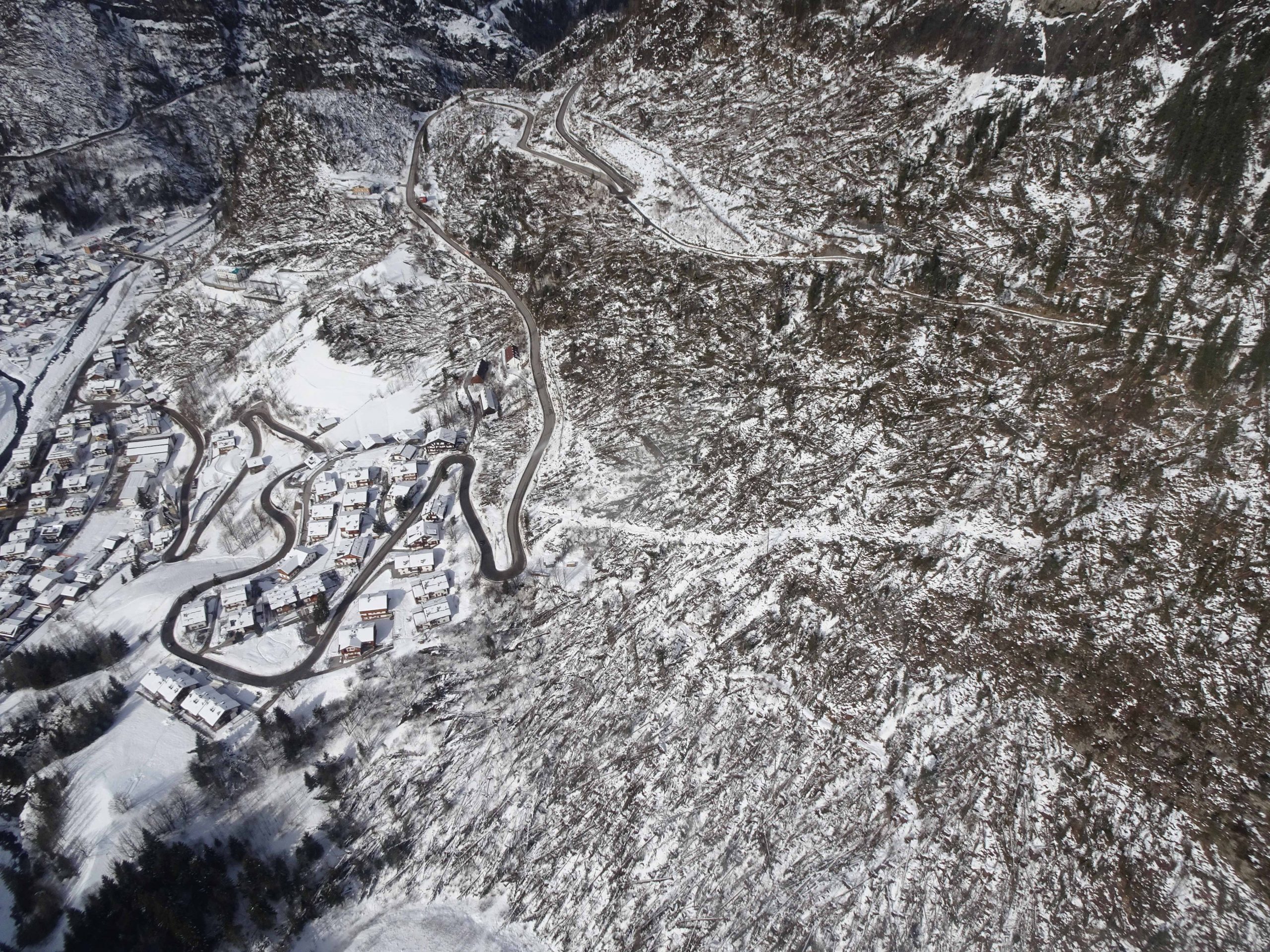
The valley develops between an altitude of around 450 m asl and 3000 m asl, corresponding to some of the main peaks of the Dolomiti group. The difference in altitude, developed in a relatively short space, gives the slopes of the Agordino a steepness that increases their vulnerability to hydrogeological instability when extreme weather events occur. The area is characterized by an heterogeneous geology, representative of all the Dolomiti lithotypes. Both brittle and plastic deformation stones can be found: limestone and dolomia are typical examples of the first class, they respond to intense atmospheric events with debris flow and rockfall; the second class is mainly represented by an alternation of sandstone and clays, and instability events usually occur through roto-translational landslides.
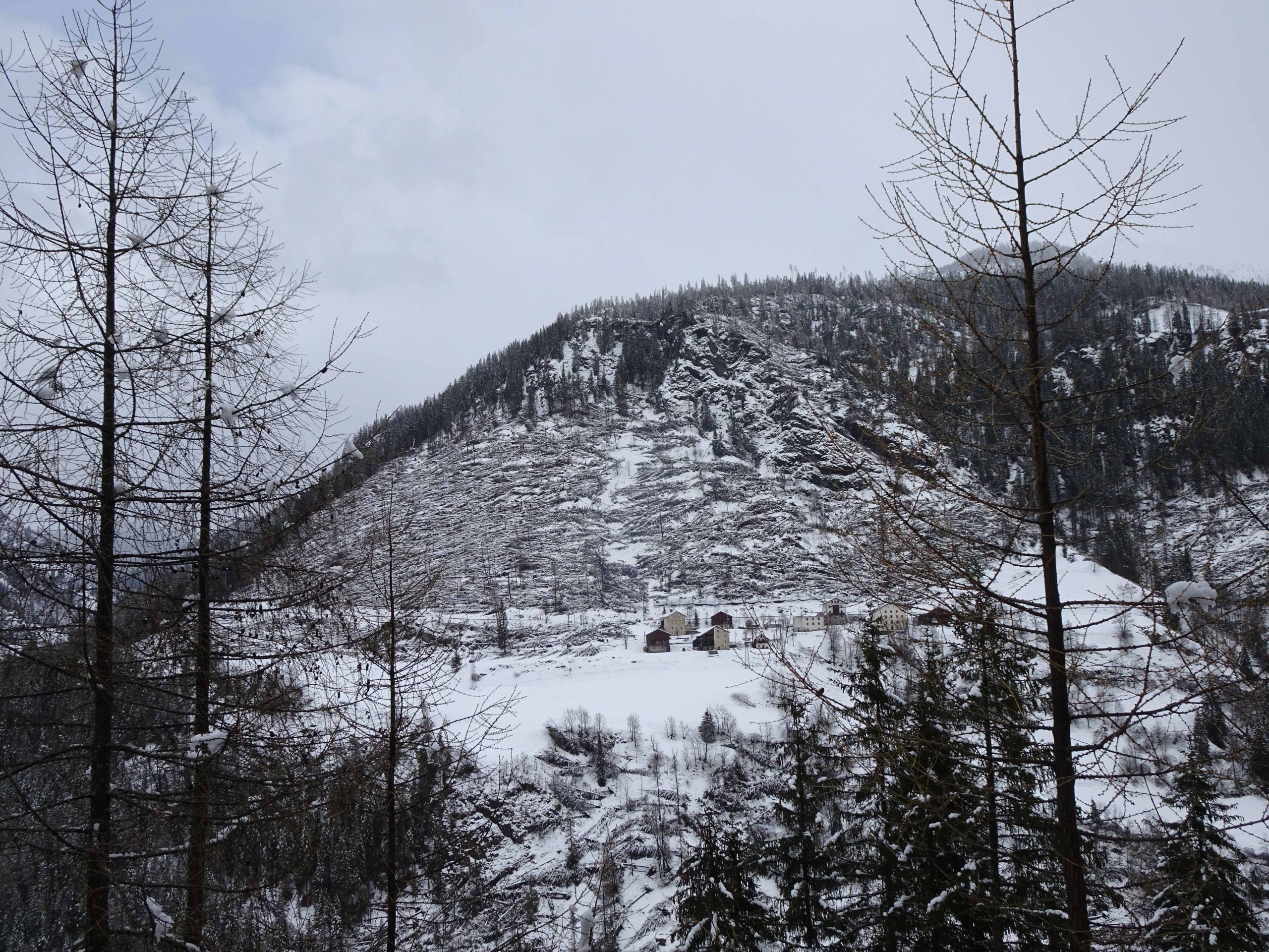
High wind has led in several occasions in the last 20 years to localised damage of forestry areas in Agordino: uprooting or cracking of branches or the trunk, that often led to road closure. VAIA struck heavily in the area, given the extreme intensity of the event, with large portion of forest tore down by the wind, the discontinuity of energy supply and road closures. In two occasions in the last 10 years strong wind caused trees to fall on high voltage wires, triggering extensive forest fires in Agordino: La Muda in 2011 and Taibon in 2018, few days before VAIA.
The Cordevole Valley is characterized by intensive snowfall, with a cumulative snow level over the year of several meters. This, and the steepness of the mountains faces, makes the valley particularly prone to avalanches. A secondary effect of VAIA was the loss of the avalanche-protection effect of the forest, with the creation of new potential avalanche sites, many of which above buildings and roads.
At the administrative level the study area consists of 16 municipalities, gathered in the Unione Montana Agordina, for a total of 18.593 inhabitants (as at 31/12/2020). Every village registered important damages after the VAIA storm, and they now have to comply to specific Civil Protection procedures, developed to face the loss of forest avalanche-protection.
The aim of the TRANS-ALP project is to develop a semi-automatic procedure for the determination of new avalanche-prone sites following intense atmospheric events. It would be a tool for the assessment of vulnerable elements and for the identification, via remote-sensing imaging and dynamic models, of snow on the ground levels critical for the triggering of avalanches endangering the vulnerable elements. Furthermore, the projects aims to the creation of a wind-intensity scale, based on the vulnerabilities of the studied area and the needs of the local stakeholders. Such classification would be a useful tool for the early warning of public administration, service management companies and, in general, all the actors that may actively take part in Civil Protection procedures in order to mitigate the risk associated with the event.

Agordino - Cordevole Valley
Agordino - Cordevole Valley

Agordino - Cordevole Valley
Agordino - Cordevole Valley
Agordino - Cordevole Valley
Agordino - Cordevole Valley