


TransAlp project conclusion
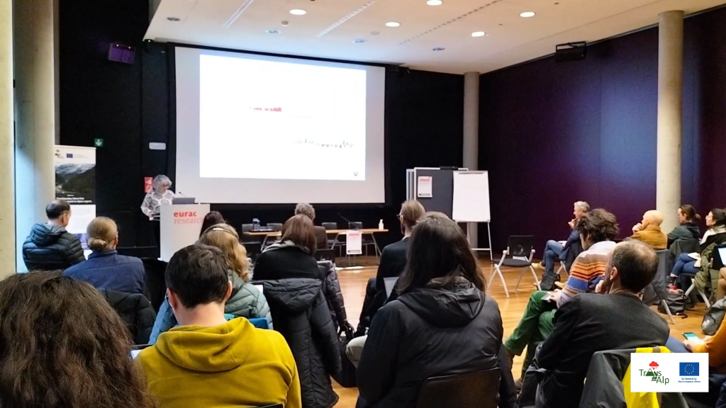
The TransAlp project ended following the international conference entitled "Climate Change and Extreme Events in the Alpine Area. How to be prepared" which was held on December 13 in Bolzano-Bozen.
The occasion featured a series of talks that focused on issues related to disaster prevention and building resilient and resistant systems to new challenges related to climate change in the mountains.
It is possible to view and download all the materials produced as a result of the project, just click here!
Final event materials are now available
All materials produced during the conference "Climate Change and Extreme Events in the Alpine Region. How to be prepared" are now available to everyone.
You can find them on the dedicated website page or by clicking here.
The conference, which took place on 13 December in Bolzano - Bozen, allowed those present to discuss the challenges of climate change at high altitudes, and in particular to focus on disaster prevention and the building of resilient systems.
All lectures were uploaded online so that they could be accessed by as many people as possible.
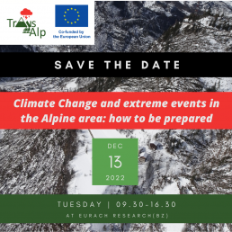
International Conference: "Climate Change and extreme events in the Alpine area: how to be prepared"
The date of the final event is approaching!
The international conference will be held in BOZEN (Italy) from 9.30 to 16.30
The meeting will be led in ENGLISH, GERMAN and ITALIAN
More info and registration form at the conference website
https://project-transalp.eu/en/international-conference/
Trans-Alp Project in the magazine RETICULA
The Trans-Alp project is featured in the 30/2022 issue of the prestigious magazine RETICULA by ISPRA!
To read the magazine, please CLICK HERE
Two conferences to present the project's results
The project partners in the upcoming days, will present their research results at two major events : the "International Mountain Conference," which will be held on September 11-15, and Disaster Research Days 2022, which will instead take place on October 13-14. Both the events will be held at the University of Innsbruck (Austria) and will be an important opportunity for experts and authorities, to discuss the various issues related to preventing disasters and building systems that are resistant and resilient to new challenges related to climate change in the mountain regions.
Below are links to the schedules for the two events
Disaster Research Days
https://www.dcna.at/index.php/en/disaster-research-days-2022.html
International Mountain Conference
https://www.imc2022.info/final-schedule/
International Workshop - Video available now
The video and materials of the International Workshop “FACING TRANSBOUNDARY EXTREME EVENTS IN ALPINE REGIONS UNDER CLIMATE CHANGE: CHALLENGES AND PERSPECTIVES” are now available at this link.
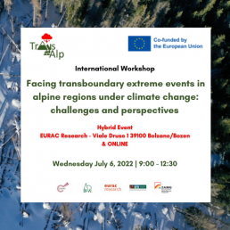
International Workshop - Facing Transboundary Extreme Events In Alpine Regions Under Climate Change: Challenges And Perspectives
The International Workshop “FACING TRANSBOUNDARY EXTREME EVENTS IN ALPINE REGIONS UNDER CLIMATE CHANGE: CHALLENGES AND PERSPECTIVES” will be held Wednesday July 6th, 2022 from 9 to 12:30 at EURAC Research, viale Druso 1, 39100 Bolzano/Bozen and also ONLINE.
The event will provide a brief overview of the activities and preliminary results of the TRANS-ALP project, with the aim to foster an interdisciplinary discussion on current and perspective risks related to extreme hydrometeorological events.
The workshop is aimed at Civil Protection authorities, Decision Makers, Risk practitioners from alpine region and other areas, as well as at partners and observers of projects working on similar topics.
The participation is free of charge but we kindly ask the participants to register for organizational purpose until Friday, July 1st, 2022.
Free registration here: https://forms.gle/a2BdfvuPP5FrscB27
Here below the link for remote connection, we will use Zoom platform:
https://scientificnet.zoom.us/j/92217588334?pwd=V3hLWGRhcmlJa2xlNHRDc2JxdU5DQT09
![]()
Publication in the italian weekly "Ambiente Informa"
On the weekly "Ambiente informa", the newsletter of the National System for the protection of the environment (SNPA), an article was published which talks about the collaboration of Arpa Veneto in the Trans-Alp project to improve risk management in mountain storms
The article is available in italian at THIS LINK and talks about the results of the project one year after the start of the activities
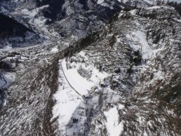
Trans-Alp field campaign at windstorm damaged forest
Trans-Alp field campaign at windstorm damaged forest slopes with susceptibility of future multi-hazard cascading effects in the pilot region of Easttyrol
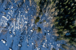
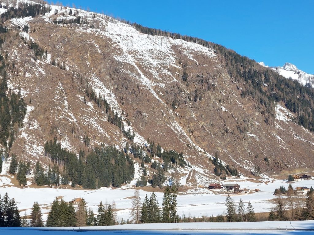
Already in the inital phase of the Trans-Alp project, the BFW contributors focused on the area of Easttyrol (a large district of the federal state Tyrol), where the severe storm VAIA (Oct. 2018) destroyed thousands of hectares of protection forests which led to about 500.000 cubic meters of damaged timber. The windthrown and mostly immediately cleaned areas are often representing steep and inaccessible slopes close above settlements or transportation routes. At some spots, responsible actors have to count with “post-storm-cascading-effects” like landslides and avalanches because of the establishment of new release areas. This fact fits properly to the topic of T3.3 “Analyses of cascading effects of storm related land cover change” which is part of the work package WP3 “Approaches and Methodologies for Storm Damage and Loss Observation and Mapping”.
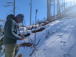
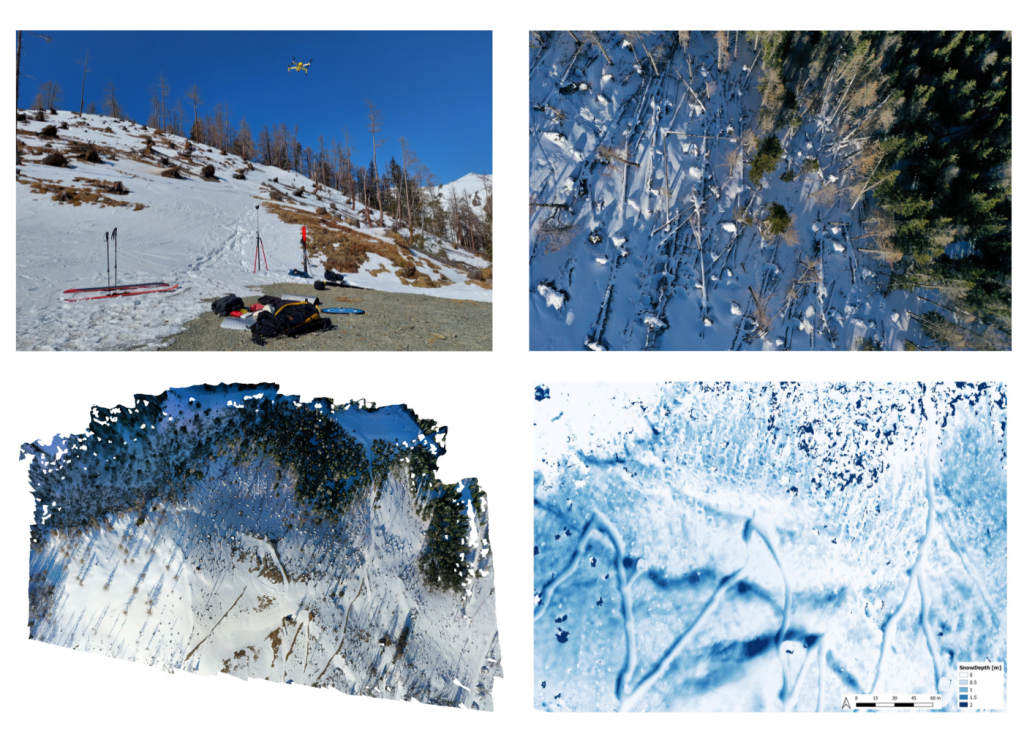
For the field campaign, one of the severely affected spots in the community of Kals am Großglockner was chosen. The campaign mainly focusses on snow distribution / snow cover formation and which effect the roughness of unmanaged windthrow areas has with regard to avalanche formation. A long-term goal is to observe the degradation of roughness over time from these unmanaged windthrow areas.
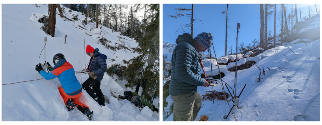
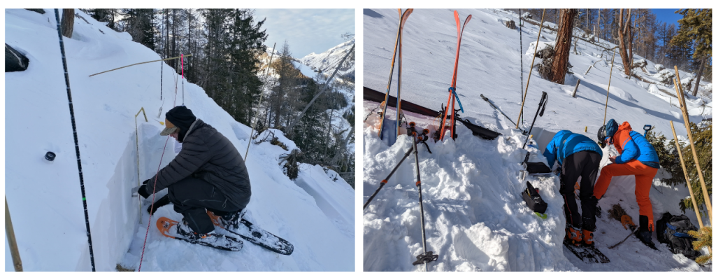
The core concept is, to examine areas in sustained forested stands, uncleaned windthrown stands (deadwood) and cleaned forest stands respectively open land. Substantial differences with regard to snow cover formation and subsequently avalanche formation are expected. The used methods include measurements with the SnowMicroPen (electric probe, developed by the SLF), drone-based photogrammetry and the recording of snow profiles. With the SnowMicroPen, the complex stratification of the snow cover (penetration resistances) and its spatial variability can be measured. This has already been done on several transects in differently vegetated terrain. The recording of snow profiles serves, among other things, as validation of the points measured with the SnowMicroPen. Drones are used to obtain a comprehensive overview of snow depth. These deliver extensive image data, which is compiled into an accurate 3D model in a complex post-processing process using point clouds. In this way, the snow depth and distribution can be observed over time and validated with the snow profiles or manual depth measurements.
Based on this examination procedures, we want to contribute to a better understanding of the formation and build-up of snow cover on storm-damaged forest areas. The overarching goal is to better assess the potentially developing multi hazard and cascading effects. In addition, the applied work processes in the frame of this field campaigns are described within the framework of deliverable 3.3 in the form of a work procedure manual and guidelines.