


Trans-Alp field campaign at windstorm damaged forest slopes with susceptibility of future multi-hazard cascading effects in the pilot region of Easttyrol
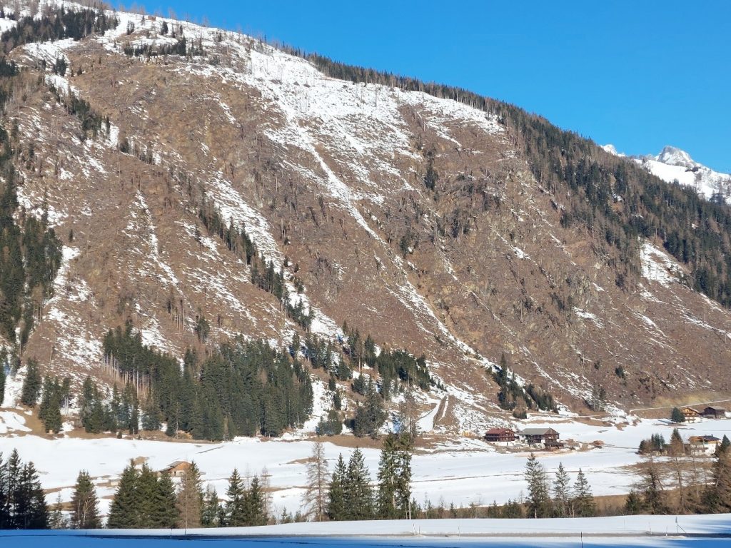
Already in the inital phase of the Trans-Alp project, the BFW contributors focused on the area of Easttyrol (a large district of the federal state Tyrol), where the severe storm VAIA (Oct. 2018) destroyed thousands of hectares of protection forests which led to about 500.000 cubic meters of damaged timber. The windthrown and mostly immediately cleaned areas are often representing steep and inaccessible slopes close above settlements or transportation routes. At some spots, responsible actors have to count with “post-storm-cascading-effects” like landslides and avalanches because of the establishment of new release areas. This fact fits properly to the topic of T3.3 “Analyses of cascading effects of storm related land cover change” which is part of the work package WP3 “Approaches and Methodologies for Storm Damage and Loss Observation and Mapping”.
For the field campaign, one of the severely affected spots in the community of Kals am Großglockner was chosen. The campaign mainly focusses on snow distribution / snow cover formation and which effect the roughness of unmanaged windthrow areas has with regard to avalanche formation. A long-term goal is to observe the degradation of roughness over time from these unmanaged windthrow areas.
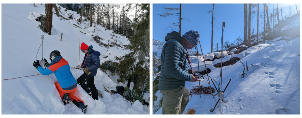
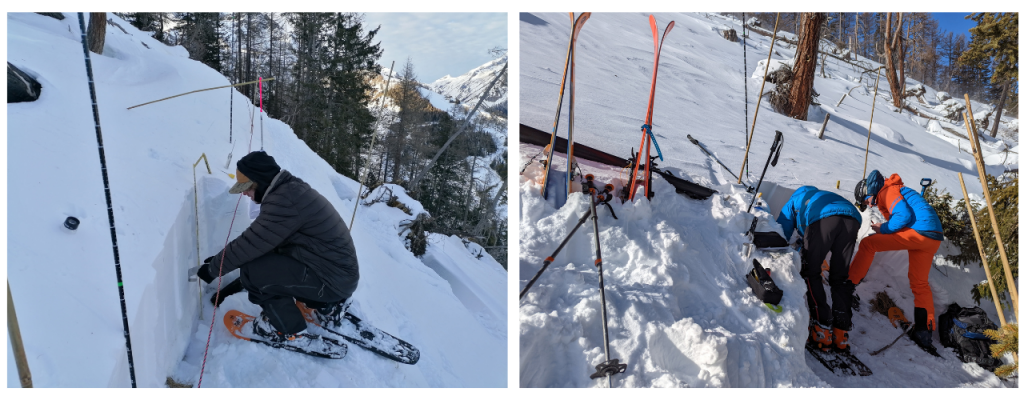
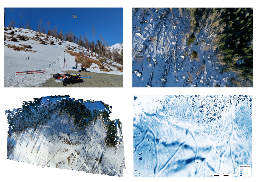
The core concept is, to examine areas in sustained forested stands, uncleaned windthrown stands (deadwood) and cleaned forest stands respectively open land. Substantial differences with regard to snow cover formation and subsequently avalanche formation are expected. The used methods include measurements with the SnowMicroPen (electric probe, developed by the SLF), drone-based photogrammetry and the recording of snow profiles. With the SnowMicroPen, the complex stratification of the snow cover (penetration resistances) and its spatial variability can be measured. This has already been done on several transects in differently vegetated terrain. The recording of snow profiles serves, among other things, as validation of the points measured with the SnowMicroPen. Drones are used to obtain a comprehensive overview of snow depth. These deliver extensive image data, which is compiled into an accurate 3D model in a complex post-processing process using point clouds. In this way, the snow depth and distribution can be observed over time and validated with the snow profiles or manual depth measurements.
Based on this examination procedures, we want to contribute to a better understanding of the formation and build-up of snow cover on storm-damaged forest areas. The overarching goal is to better assess the potentially developing multi hazard and cascading effects. In addition, the applied work processes in the frame of this field campaigns are described within the framework of deliverable 3.3 in the form of a work procedure manual and guidelines.